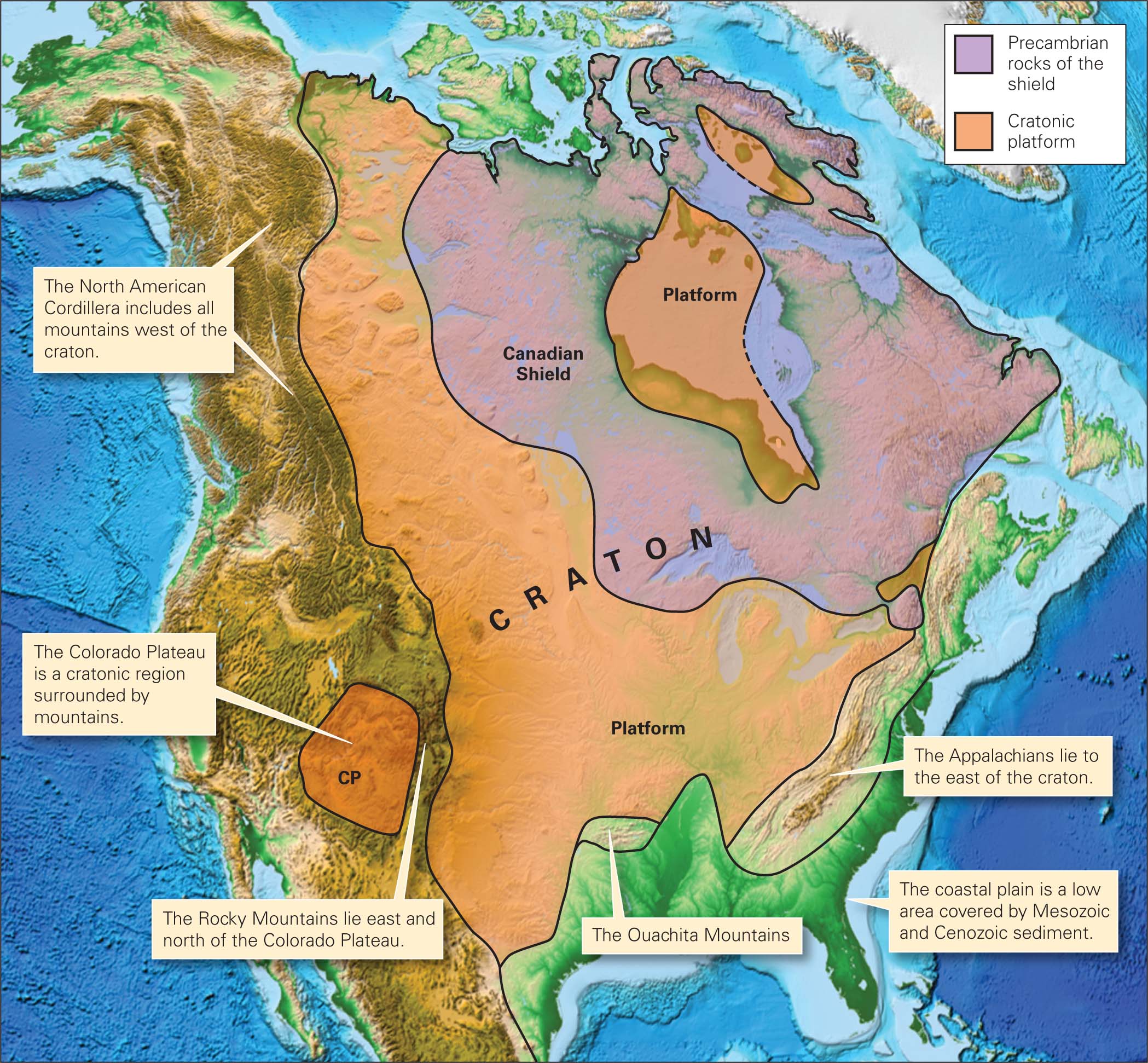
A craton consists of crust that has not been affected by orogeny for at least a billion years. As a result, cratons have cooled substantially, and therefore they have become relatively strong and stable. In North America, the craton forms the interior of the continent—during Phanerozoic time, mountain belts (the North American Cordillera on the west, the Appalachians on the east, and the Ouachitas on the south) formed along the margins, not within the craton. Geologists divide cratons into two provinces: shields, where Precambrian metamorphic and igneous rocks crop out at the ground surface, and cratonic platforms, where a relatively thin layer of Phanerozoic sediment covers the Precambrian rocks (Fig. 9.24).
FIGURE 9.24 North America’s craton consists of a shield, where Precambrian rock is exposed, and a cratonic platform, where Paleozoic sedimentary rock covers the Precambrian rock.
In shields, we find widespread exposures of intensively deformed metamorphic rocks with abundant examples of passive-flow folds and tectonic foliation. That’s because the crust making up the cratons was deformed during a succession of orogenies in the Precambrian. These orogens are so old that erosion has worn away the original peaks, in the process exhuming deep crustal rocks.
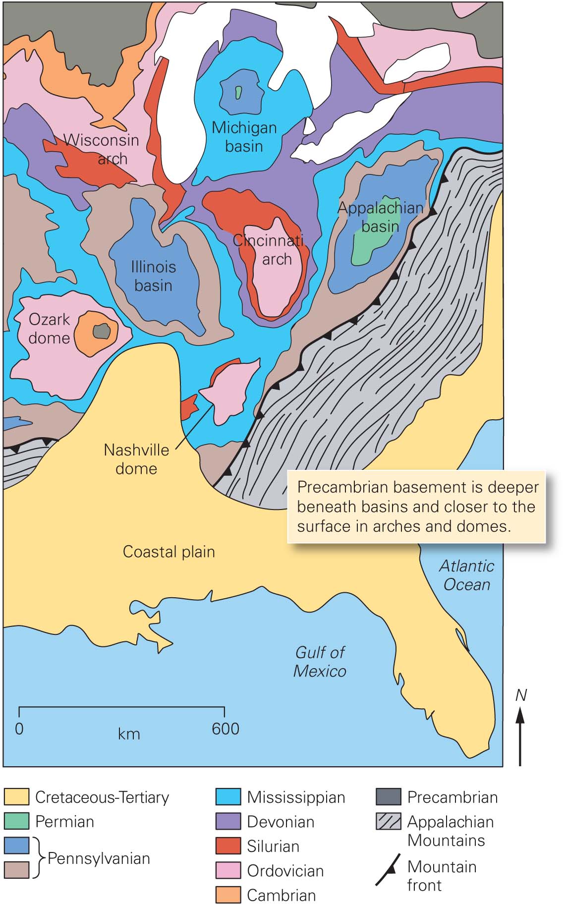
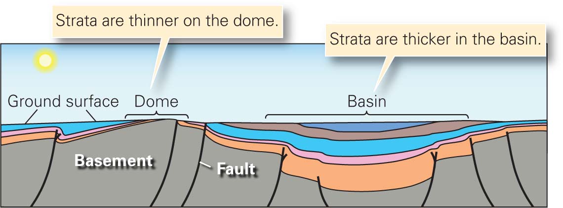
In cratonic platforms, the pattern of contacts between stratigraphic formations typically defines regional domes and basins as well as arches (elongate domes) (Fig. 9.25). For example, in Missouri, strata arch across a broad uplift, the Ozark dome, whose diameter is 300 km. Individual sedimentary layers thin toward the top of the dome, because less sediment accumulated on the dome than in adjacent basins. Erosion during more recent geologic history has produced the characteristic bull’s-eye pattern of a dome, with the oldest rocks (Precambrian granite) exposed near the center. To the east, in the Illinois basin, strata warp downward into a huge bowl that is also about 300 km across. Strata get thicker toward the basin’s center, indicating that the floor of the basin was subsiding at the same time sediment was accumulating—there was more room for sediment to accumulate where the basin subsided the most. The basin also has a bull’s-eye shape, but here the youngest strata are exposed in the center. Geologists refer to the vertical movements that generate these huge, but gentle, mid-continent domes and basins as epeirogeny (from the Greek epeiros, meaning mainland or continent).
FIGURE 9.25 Domes and basins of the North American cratonic platform.
(a) A geologic map of the U.S. mid-continent platform region showing the locations of basins and domes.(b) A cross section showing how strata thin toward the crest of a dome and thicken toward the center of a basin. The cross section is vertically exaggerated and symbolically represents the Ozark dome and Illinois basin.
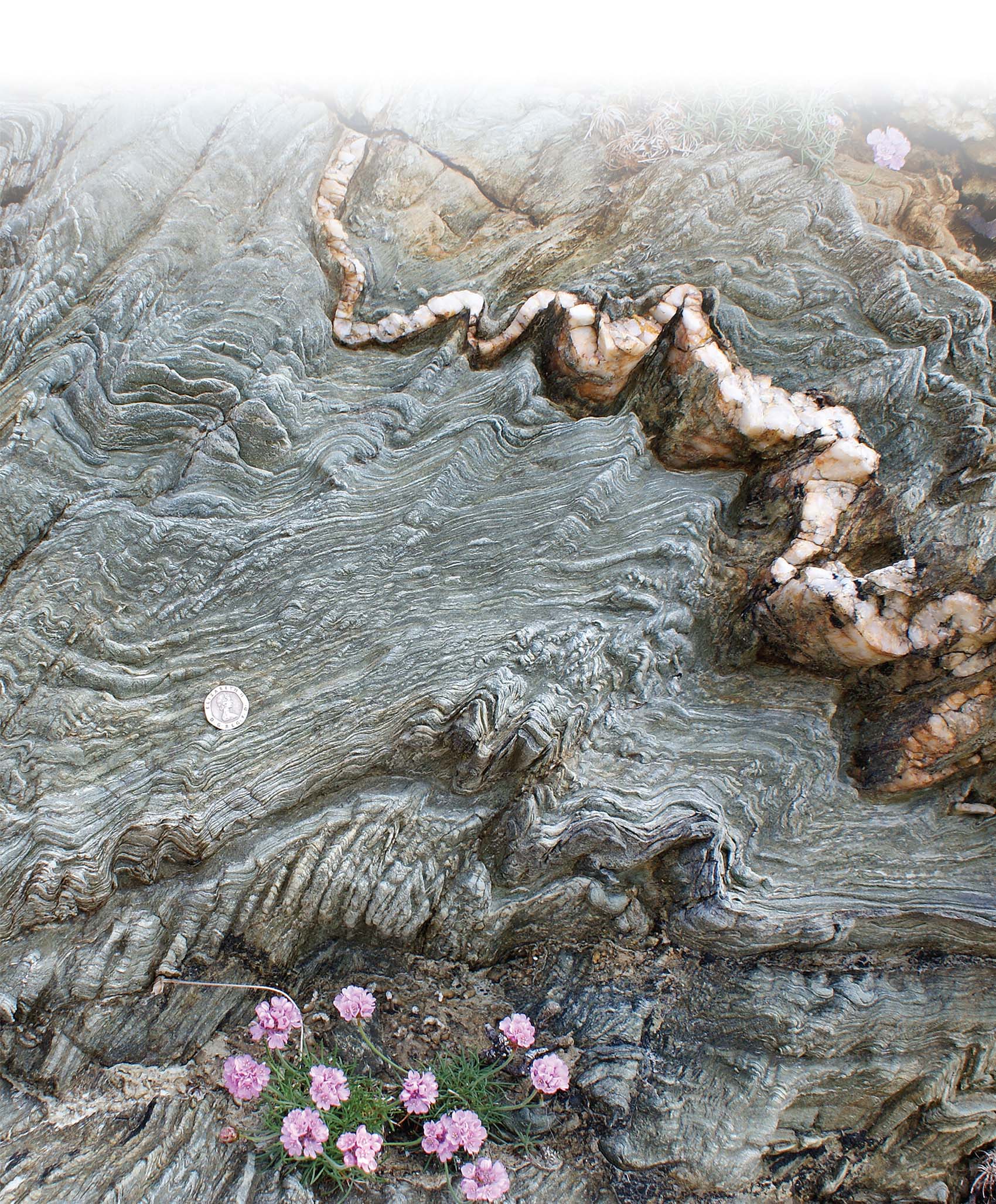
ANOTHER VIEW Compression of this phyllite in Wales resulted in a train of microscopic folds. A white quartz vein, which cut through the phyllite before crenelation formed, has also been folded. The stress that caused this folding was a consequence of mountain building during the Paleozoic. The mountains have long since eroded away, exposing these rocks, which were deformed at a depth of about 20 km.
TAKE-HOME MESSAGE
Cratons are portions of continents that consist of very old and relatively stable crust. Parts of cratons may be covered by Paleozoic sedimentary strata. Variations in the dip and in the thickness of these strata define regional basins and domes.
QUICK QUESTION: Imagine that coal occurs in a particular stratigraphic unit. Will mines to reach the coal be deeper or shallower in the center of a basin?